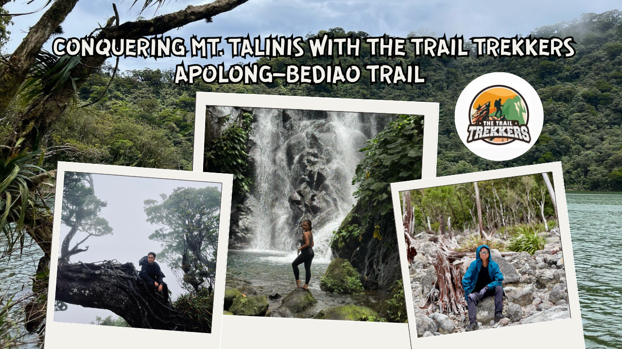
Chasing the Clouds: Conquering Mt. Talinis with The Trail Trekkers
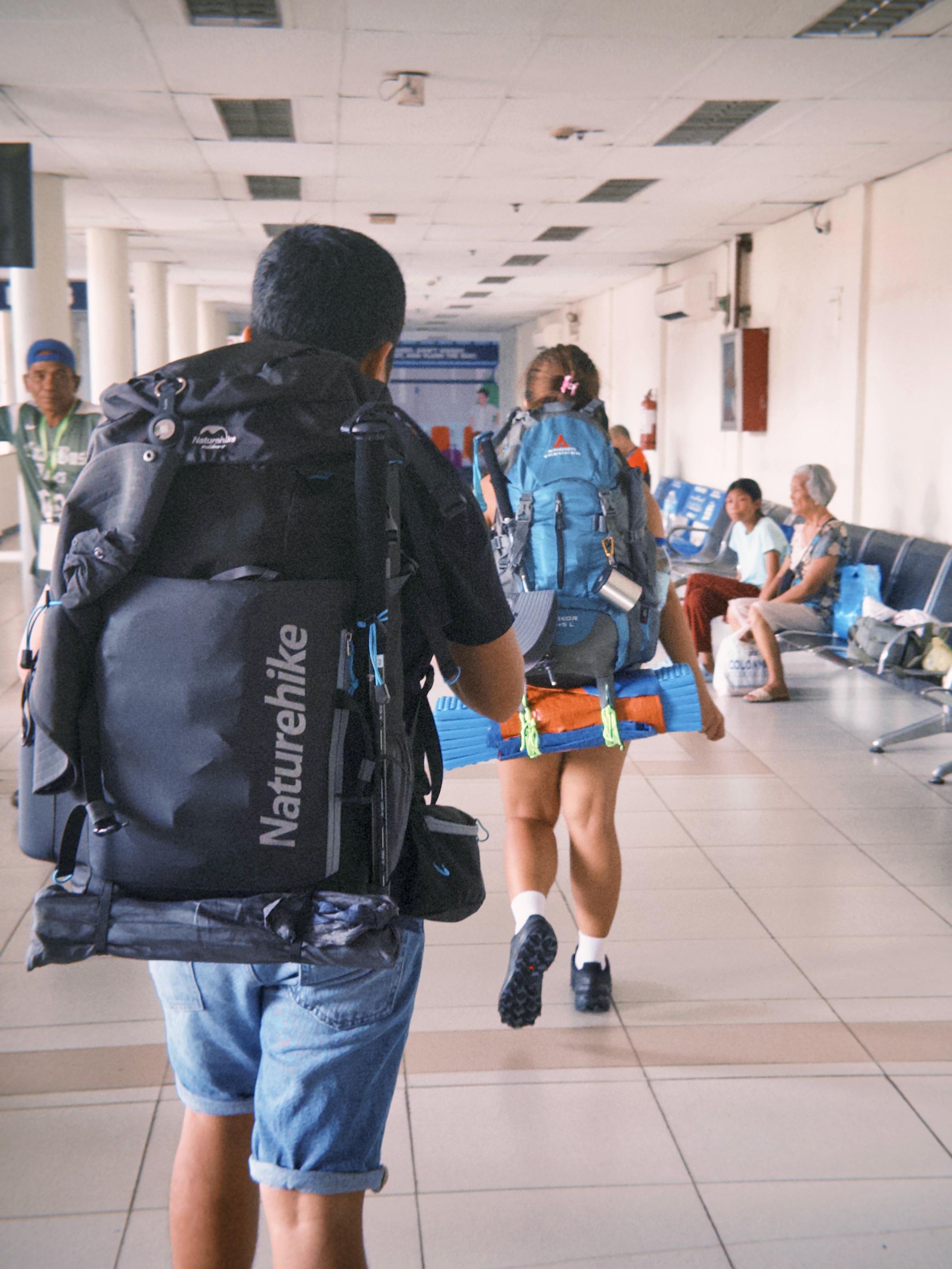
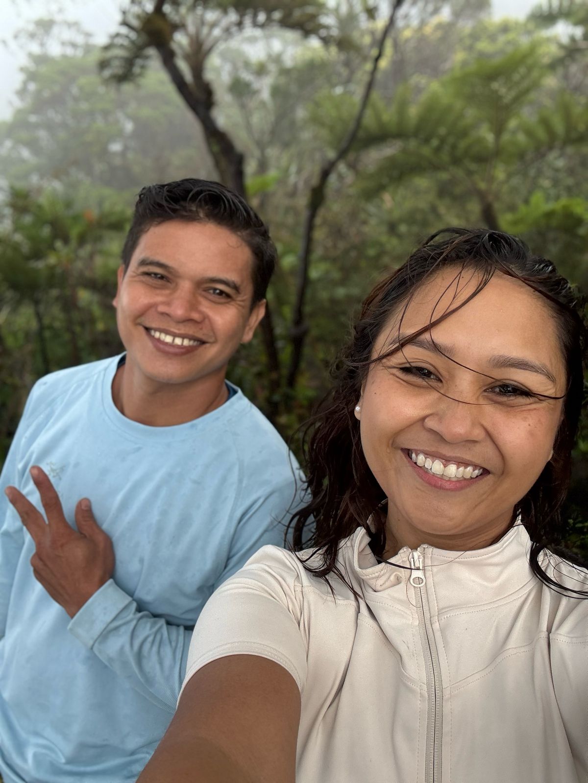
After three months of prepping, Louj, Troy, and I finally did it. We conquered our first-ever major hike: the majestic Mt. Talinis. The second-highest peak in Negros Island, next to Mt. Kanlaon which stand tall at 1,903 meters above sea level.
But before we get into the climb itself, let me tell you how it all began.
It started during a chill camping trip back in January. We were just enjoying the cool night breeze, talking about life and random things, when I may or may not have brought up the idea of doing something "next level." Something that involved, well... a mountain like Talinis.
I described the lakes, the summit, the mystic fog and I guess I made it sound too magical, because somehow, by the end of that night, they said yes. My friends, who weren’t really into hiking before, suddenly found themselves doing prep hikes, braving steep trails, and slowly building up their strength. I was so proud to watch them discover the same love for the outdoors that I’ve always had.
Eventually, we found ourselves face to face with Mt. Talinis, also known as Cuernos de Negros (Horns of Negros) - a beautiful but brutal mountain known for its technical trails, steep assaults, and unpredictable weather.
Our team booked the climb with The Trail Trekkers, a highly recommended local organizer. Shoutout to Charlotte and Joey, who picked us up bright and early from Dumaguete at 5:30 AM. From there, we headed to Apolong, Valencia, our jump-off point.
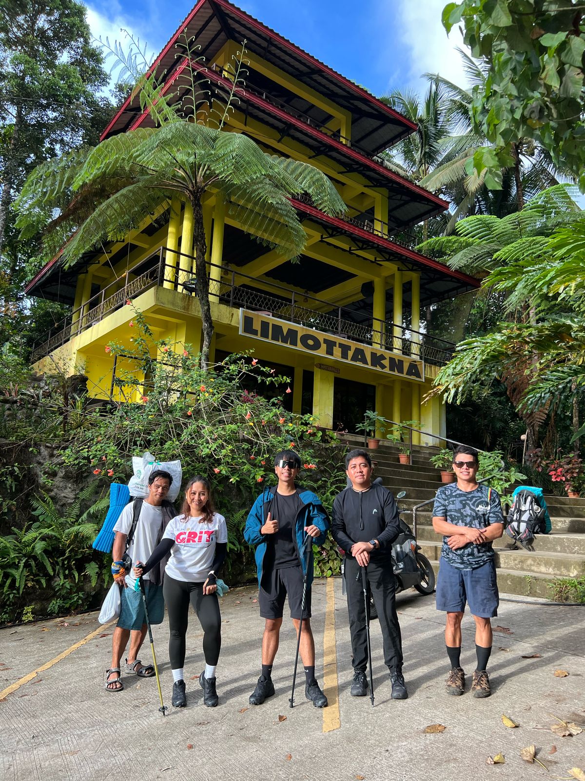
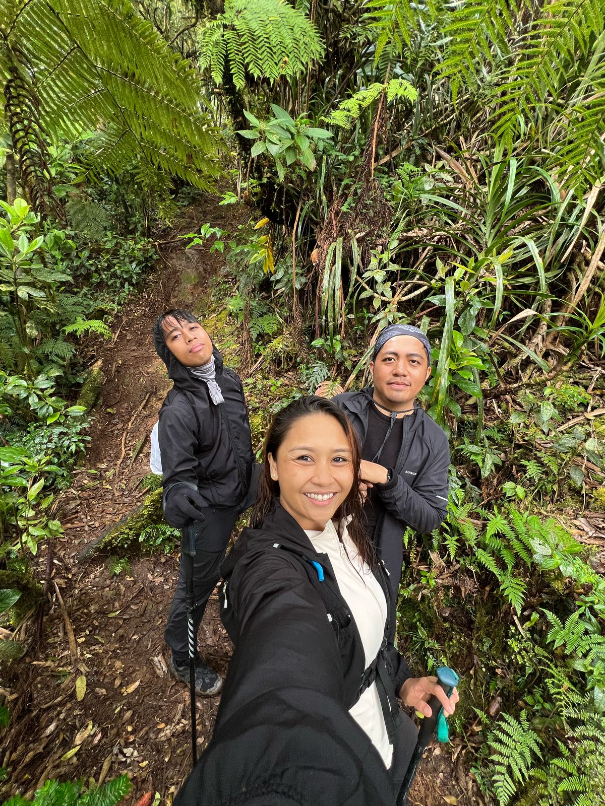
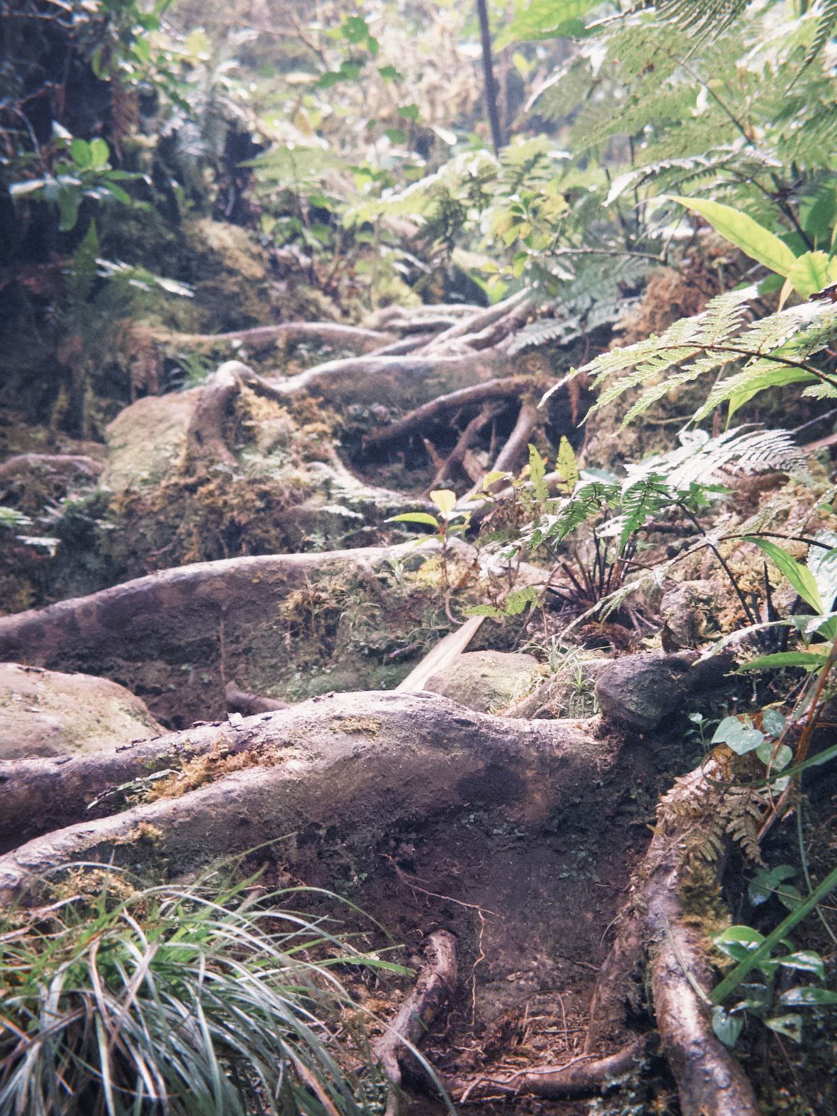
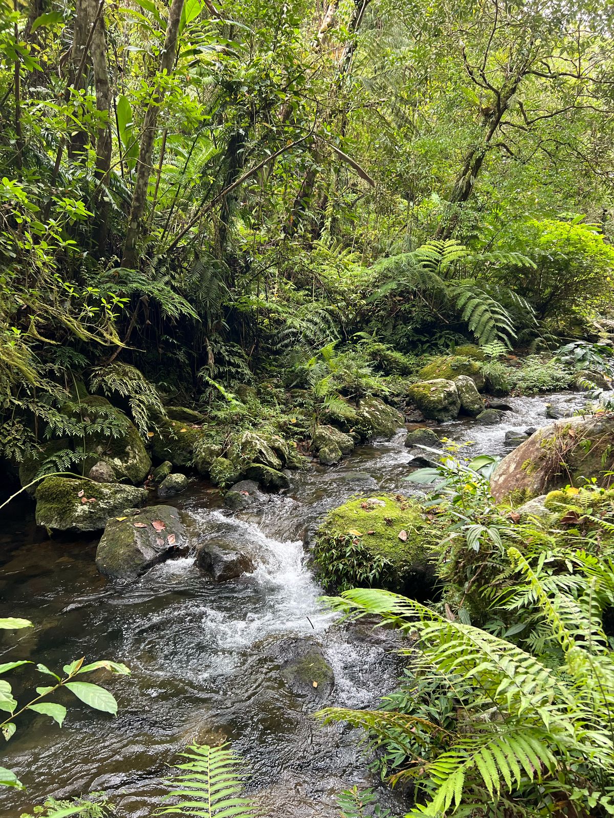
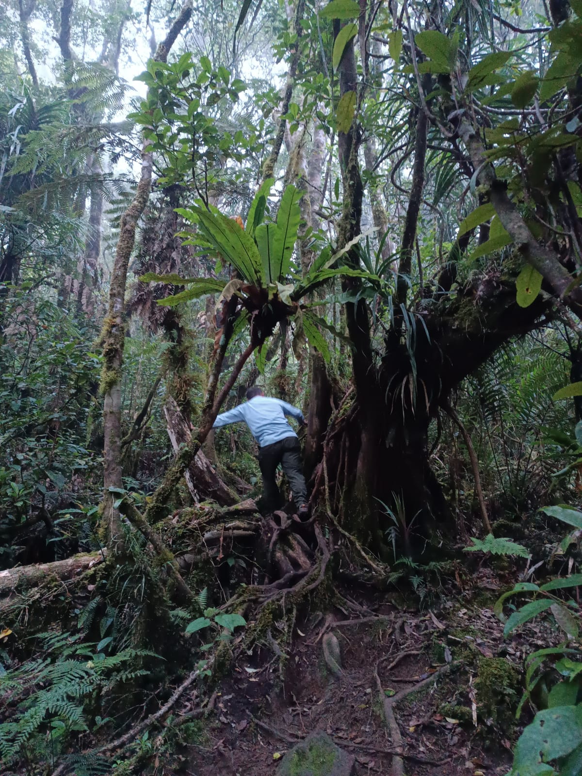
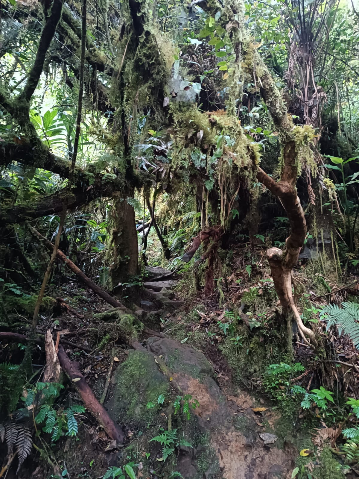
The Apolong–Bediao Traverse is the longer and more challenging route. It took us through mossy forests, slippery rock paths, and steep inclines that felt like we were climbing stairs to heaven — except there were no stairs, just roots, rocks, and sheer determination.
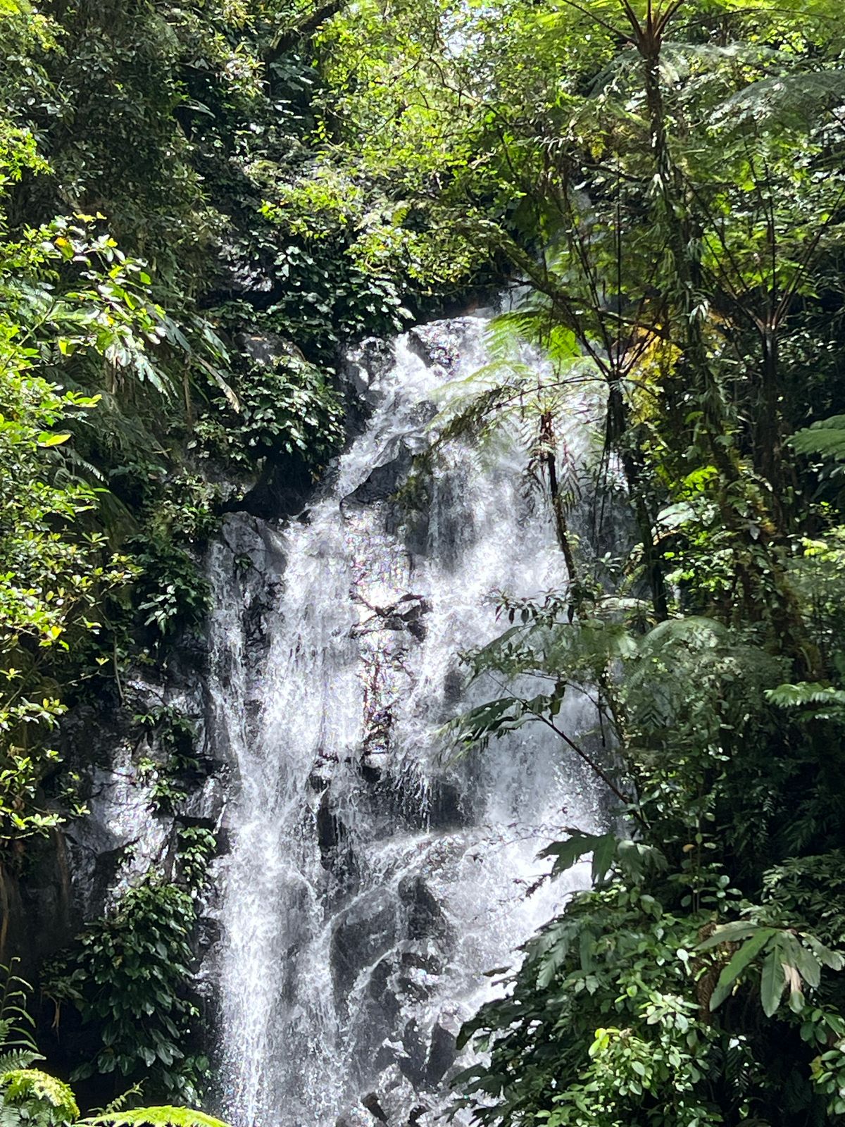
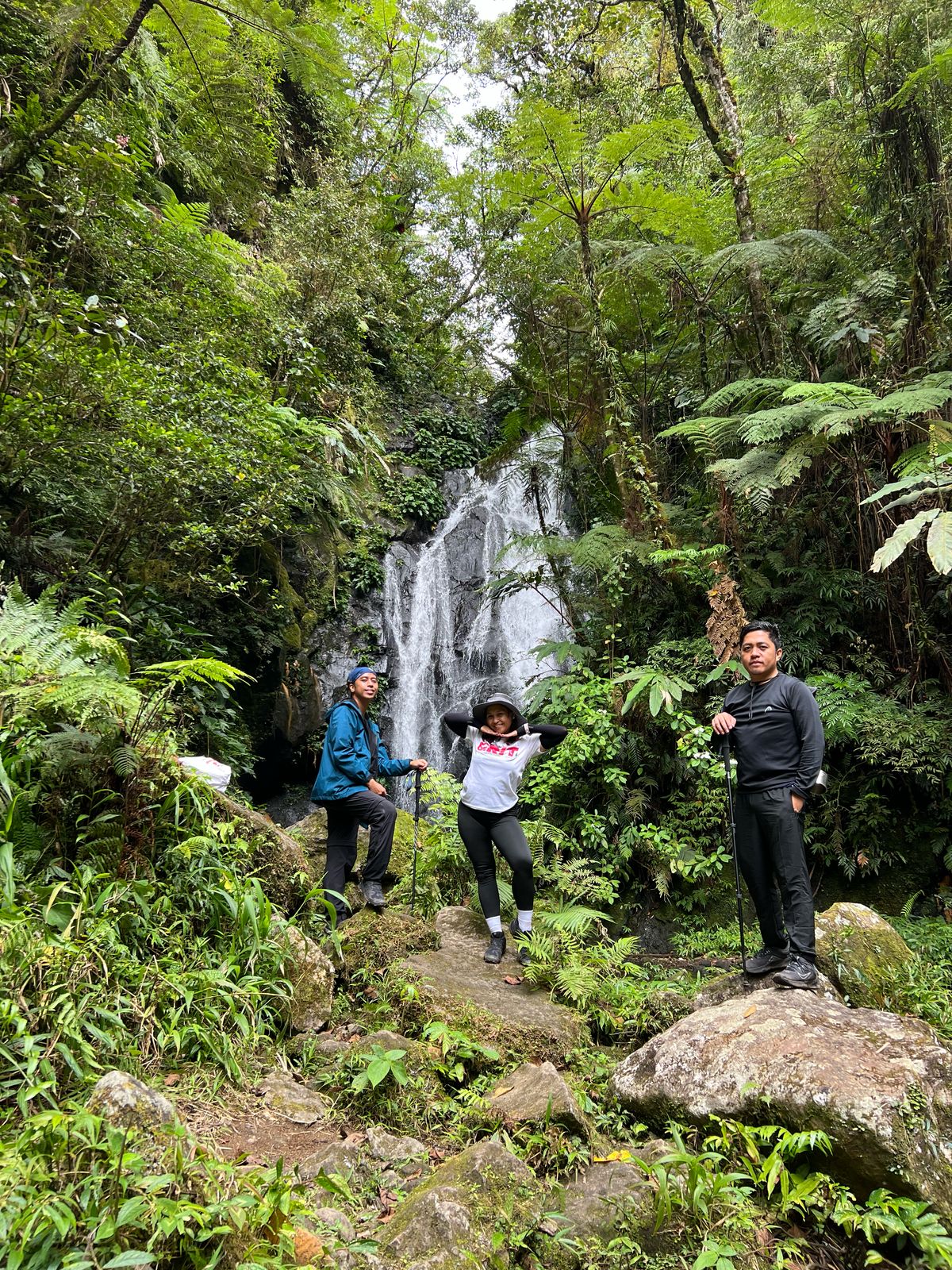
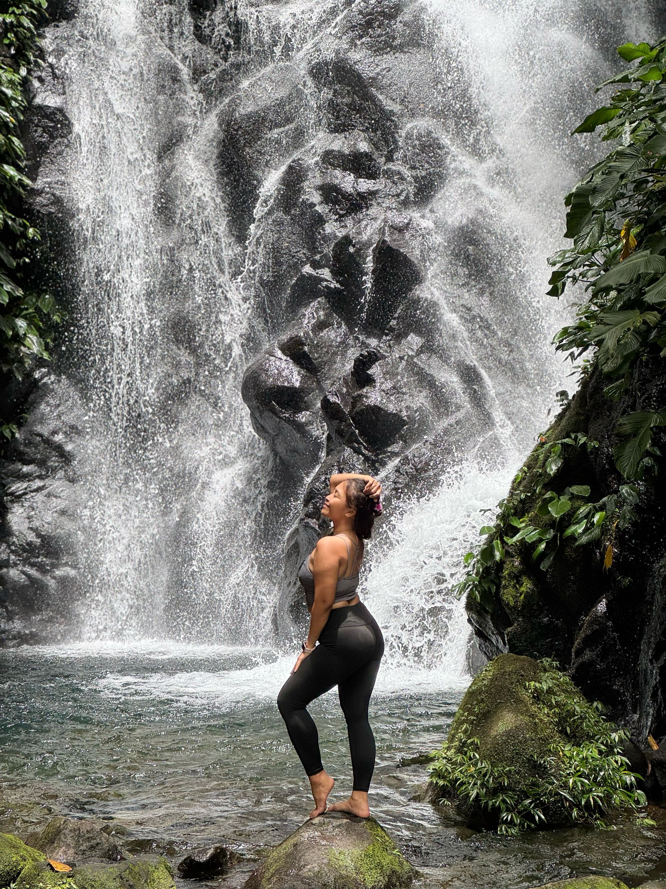
Despite the difficulty, the trail offered incredible moments. Along the way, we passed several stunning landmarks. We first dropped by the Ranger Station, where we rested briefly before heading to the majestic Twin Falls, the sound of nature and the water flowing from the falls was just dreamy, the waters was cold and clear, it offered us a refreshing dip before we head back to the trail.
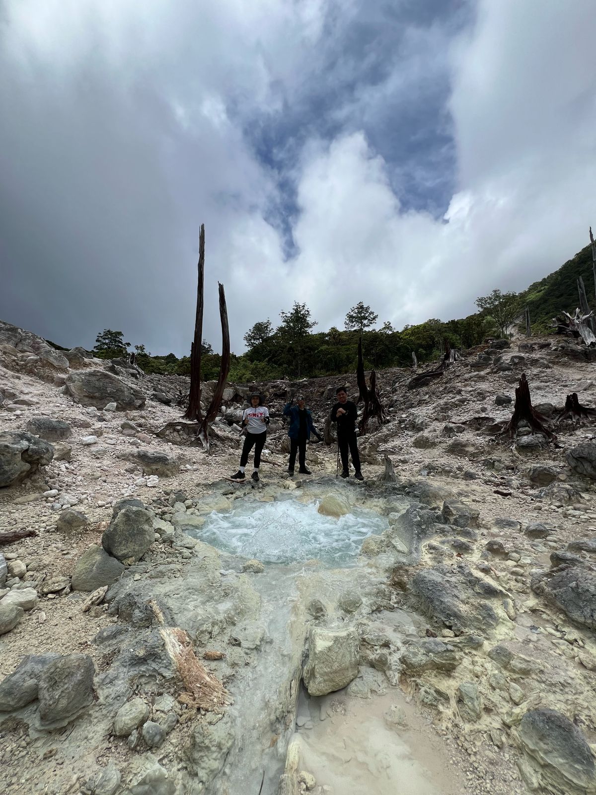
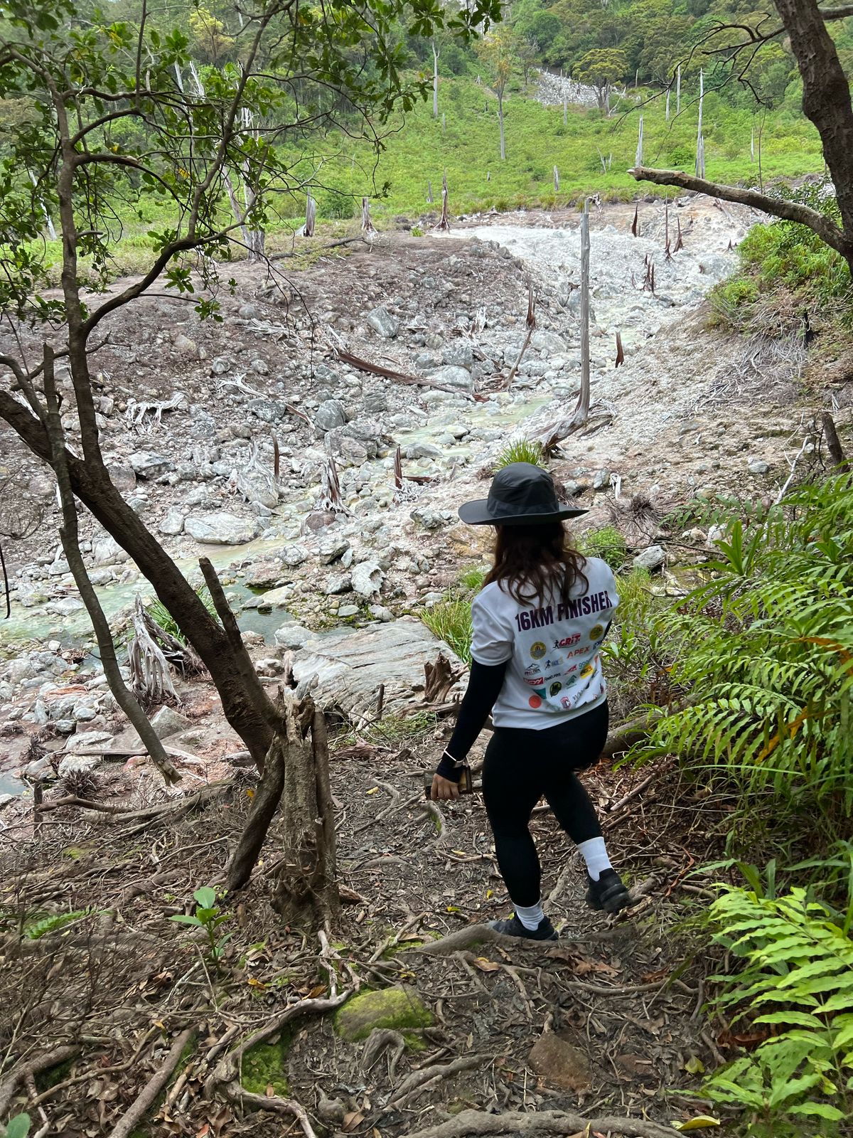
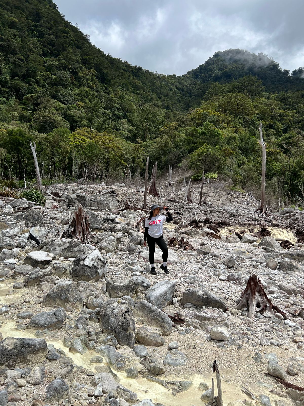
Then came the Sulfur Vents. The smell hit us before we even saw them, a clear reminder that Talinis sits on volcanic ground. Our guide advised us to just spend a maximum of 15 minutes in the sulfur vent cause of the rotten egg smell which may also cause difficulty in breathing.
The terrain kept shifting — from forest paths and rivers to waterfalls, rocky sections, and what felt like a never-ending assault on day one.
Although there’s a freshwater stream up to Rancho, water becomes scarce beyond that point. There are no reliable water sources from Rancho to Lake Nailig, and none at all on the way to the summit or during the descent the next day. I carried only 2 liters, which was just enough thanks to the cold weather keeping my consumption low.
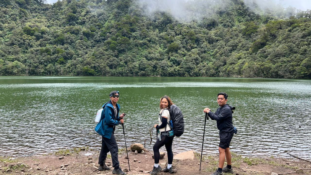
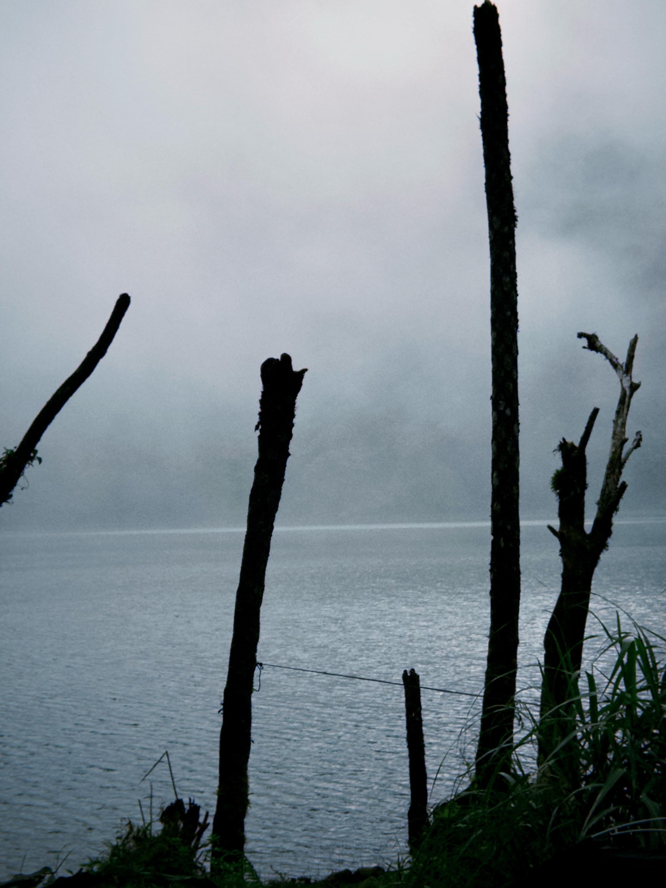
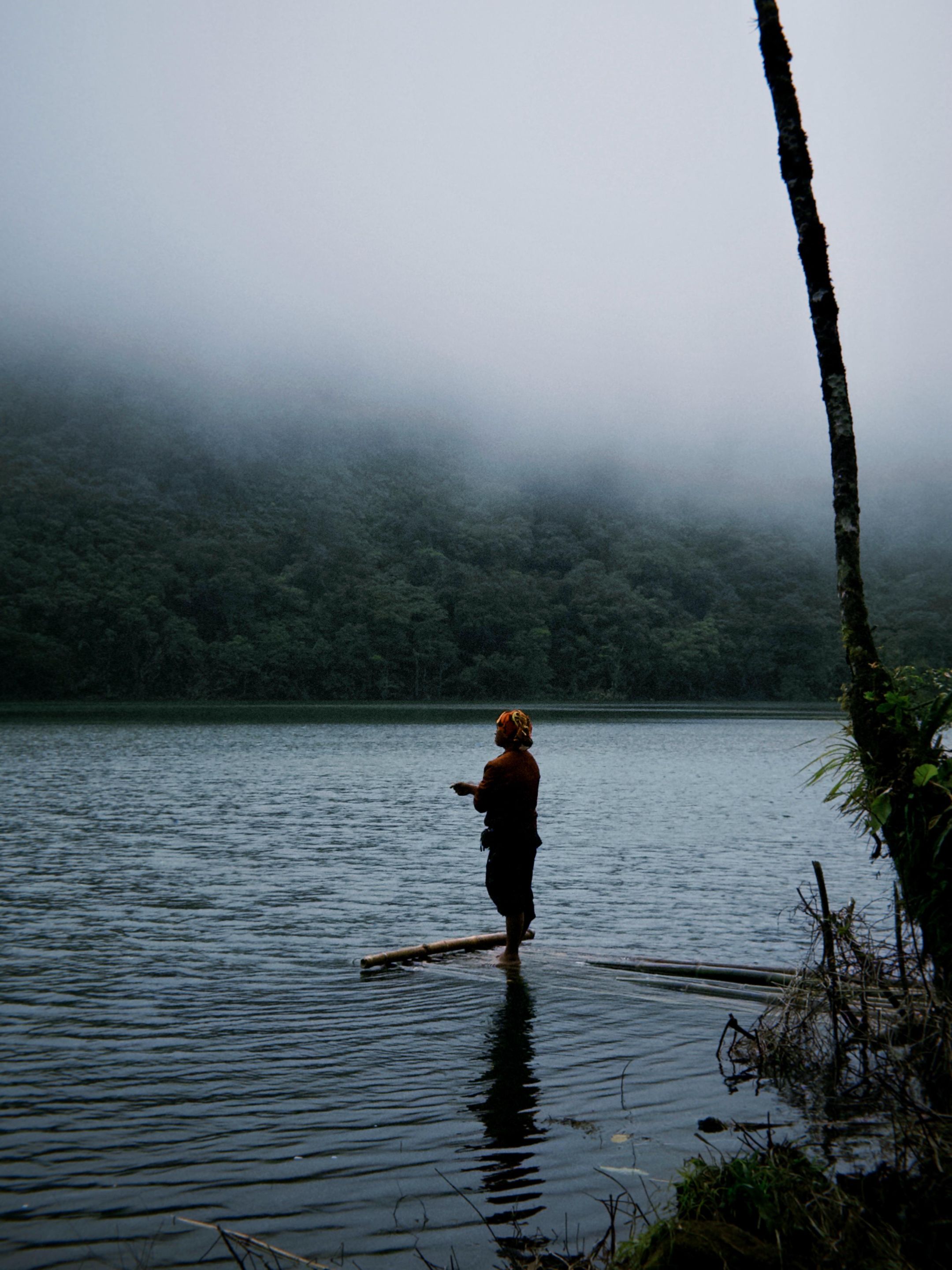
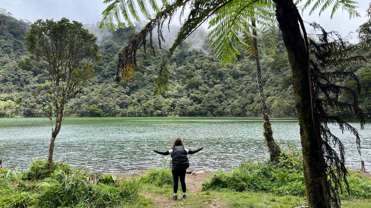
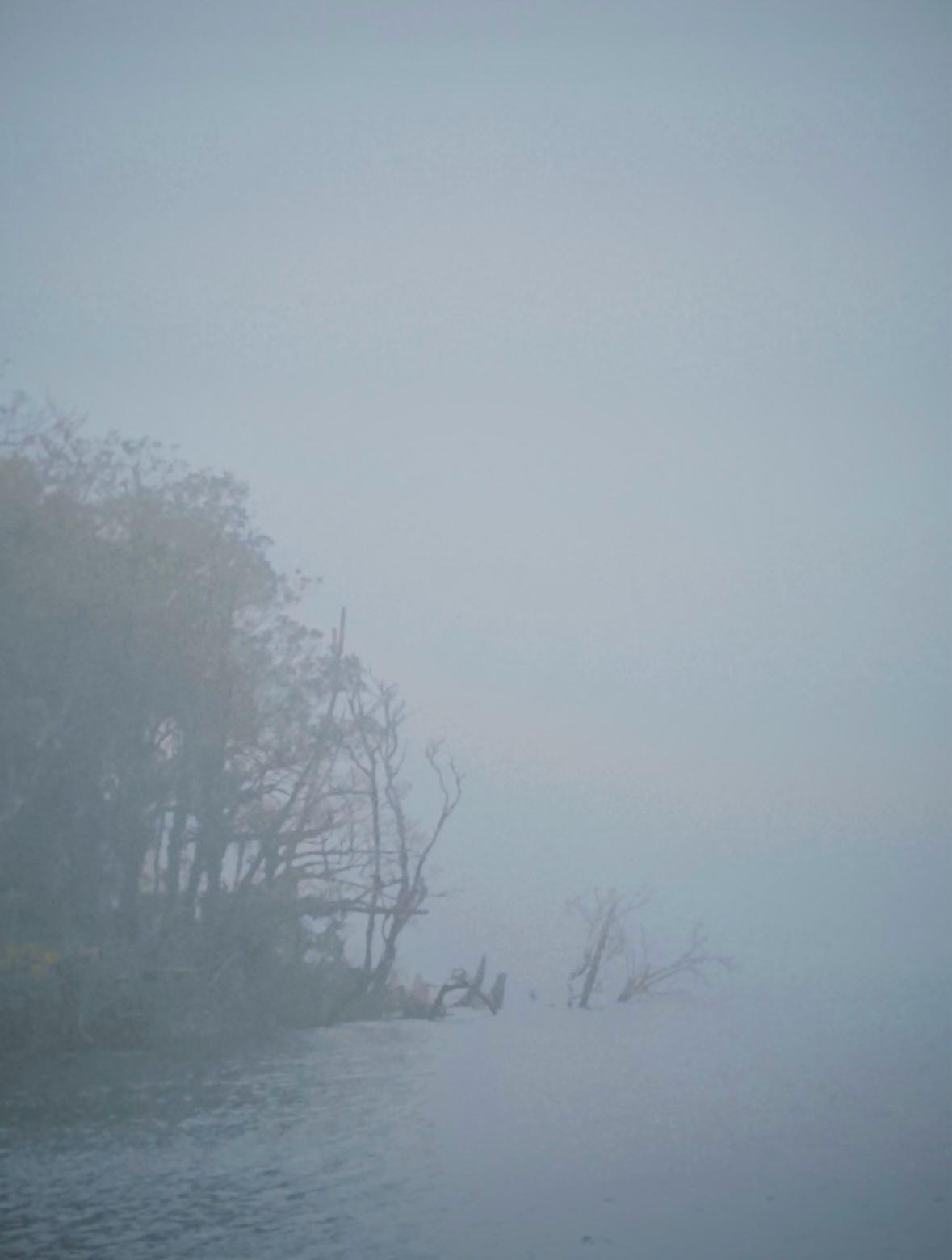
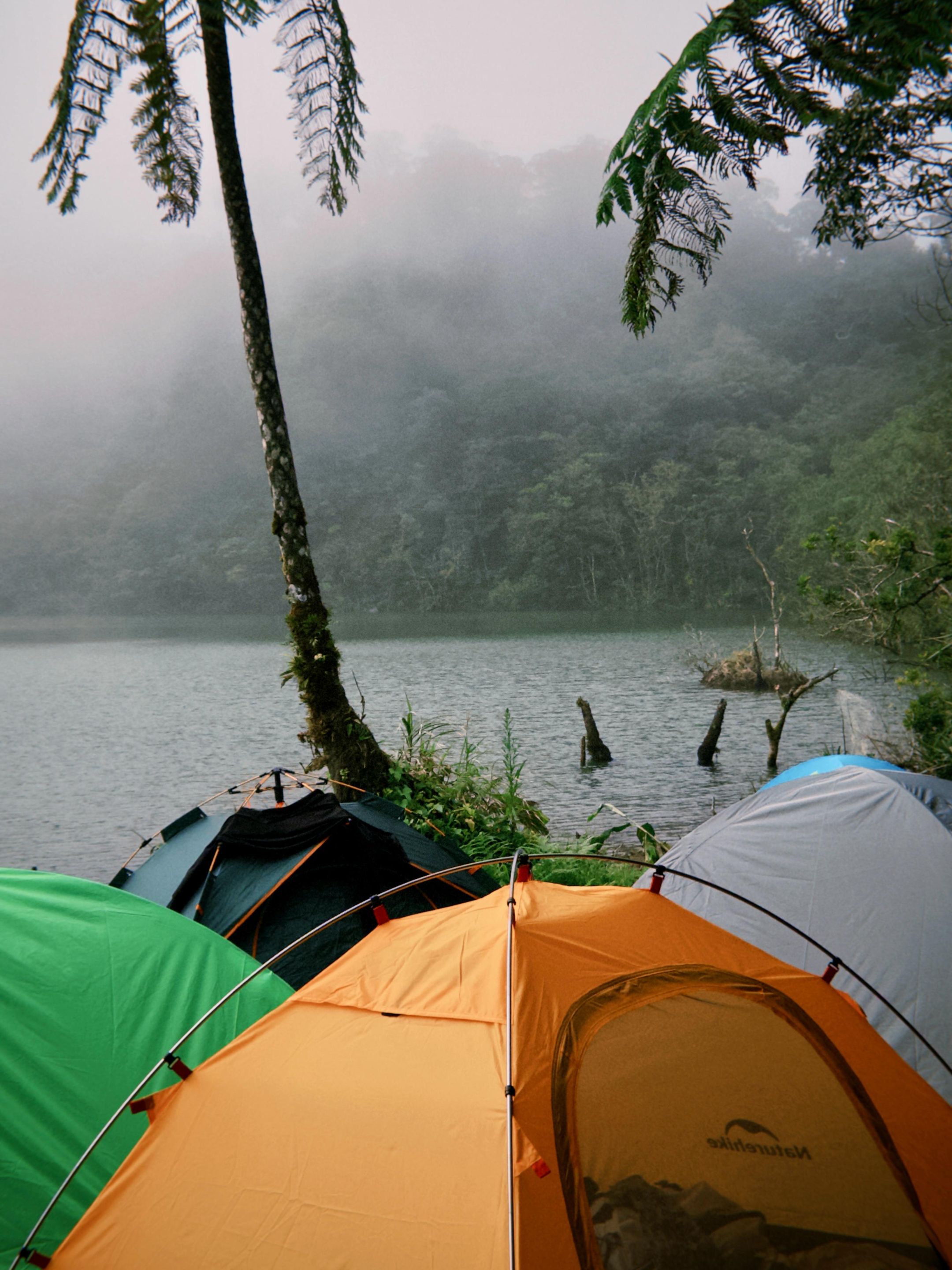
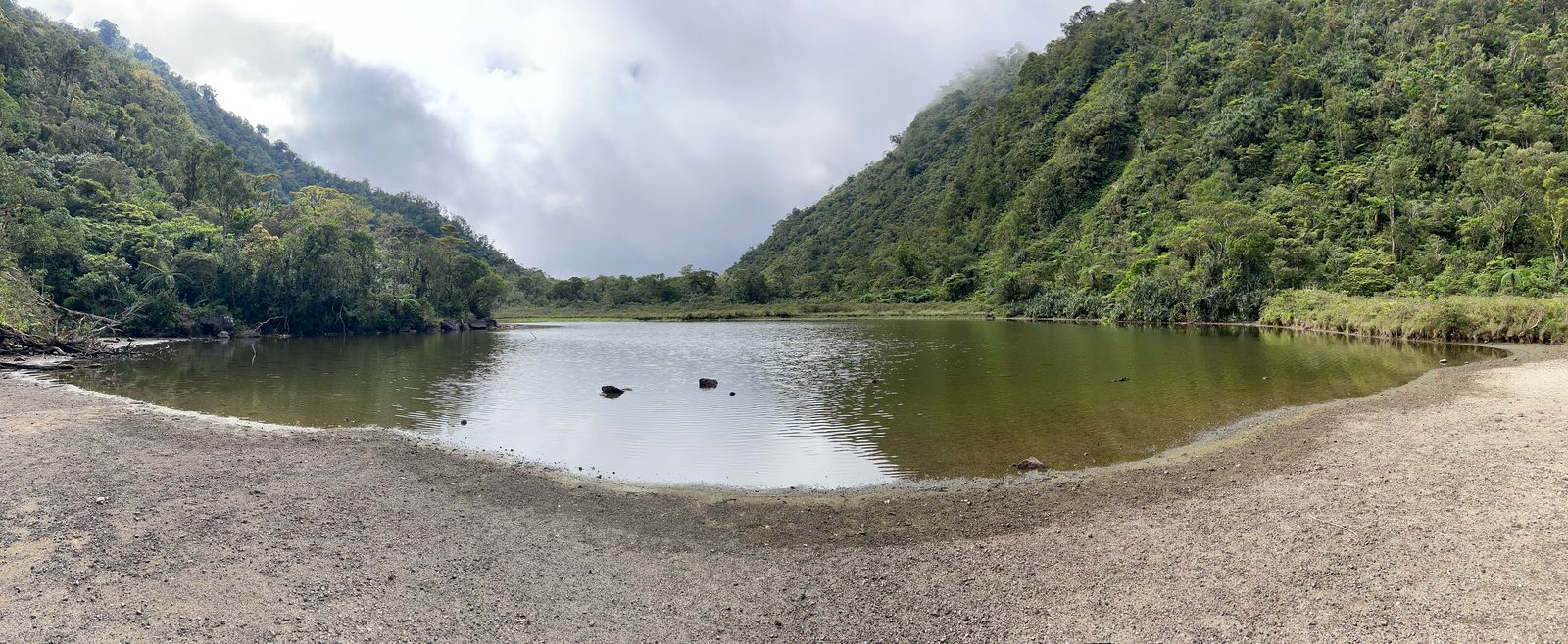
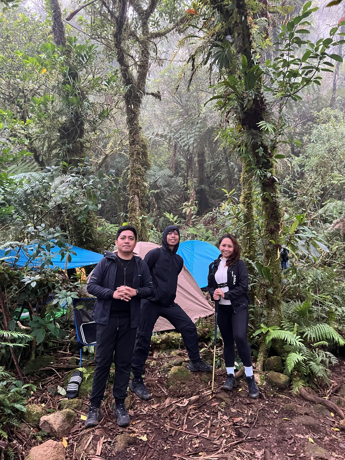
By late afternoon, we reached Lake Nailig, our campsite for the night. It’s a surreal place, a combination of quiet, misty, and moody. It was like a scene straight out of a horror film. When we arrived, the fog had taken over, and visibility was low. But the next morning, as the fog lifted, we were rewarded with a view that made the entire grueling hike worth it. The lake revealed itself in full beauty: serene, still, and stunning.
On summit day, we woke up at 5:00 AM and had some coffee before heading out around 6:00. The final push to Nacolon Peak took about an hour of straight uphill assault. Some parts felt close to a 90-degree angle where we had to cling onto rocks and roots, scrambling like monkeys. (No wonder they call it the Monkey Trail.) The trail demanded full focus and strength.
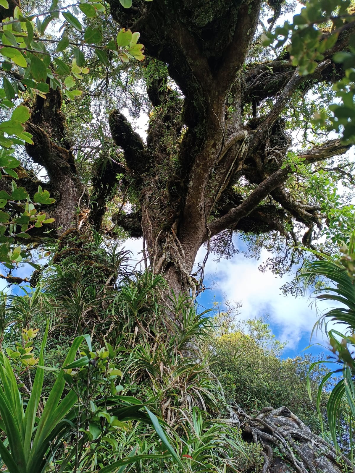
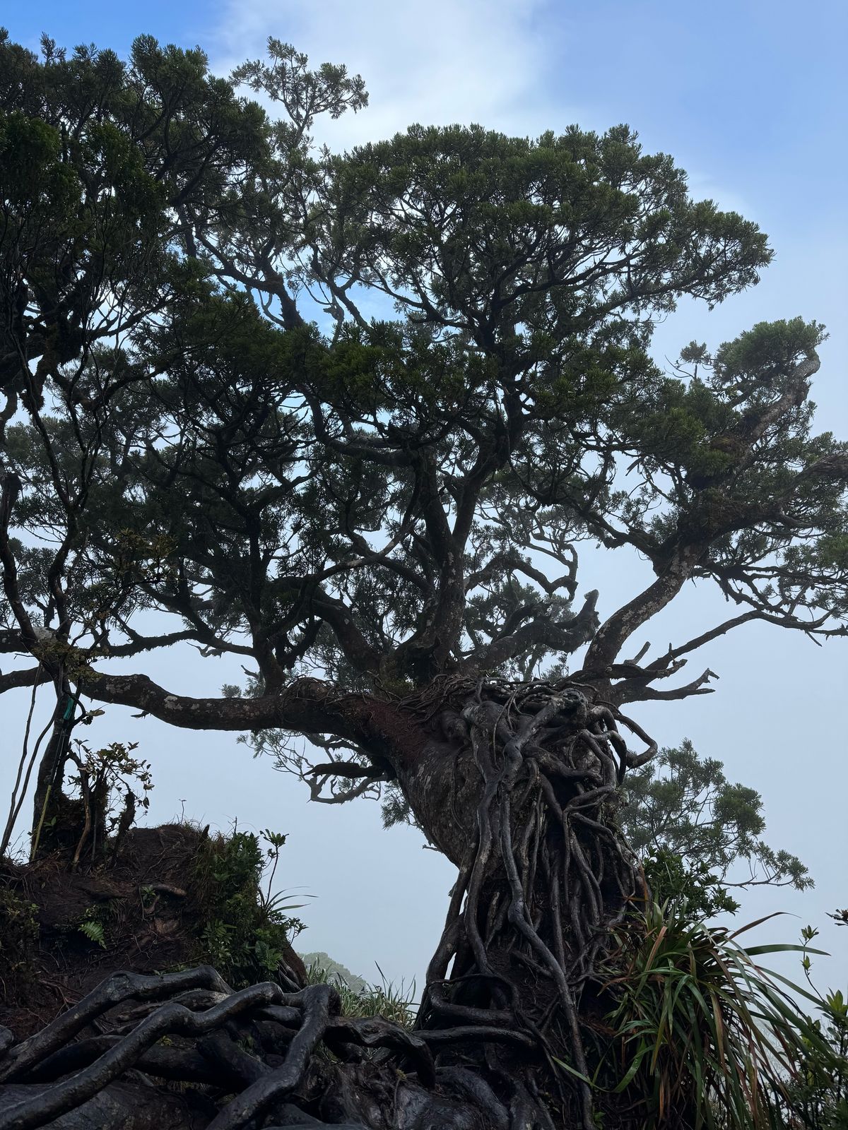
At the summit stood the famous Maribuhok Tree, like a lone sentinel guarding the peak. We waited, hoping for a clearing, but the winds were harsh and the summit was covered with fog. Still, we were grateful. Not everyone reaches the summit, and we did.
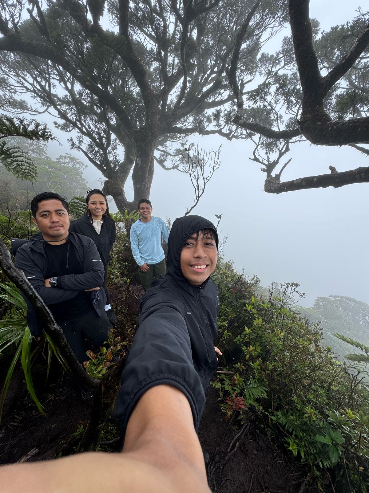
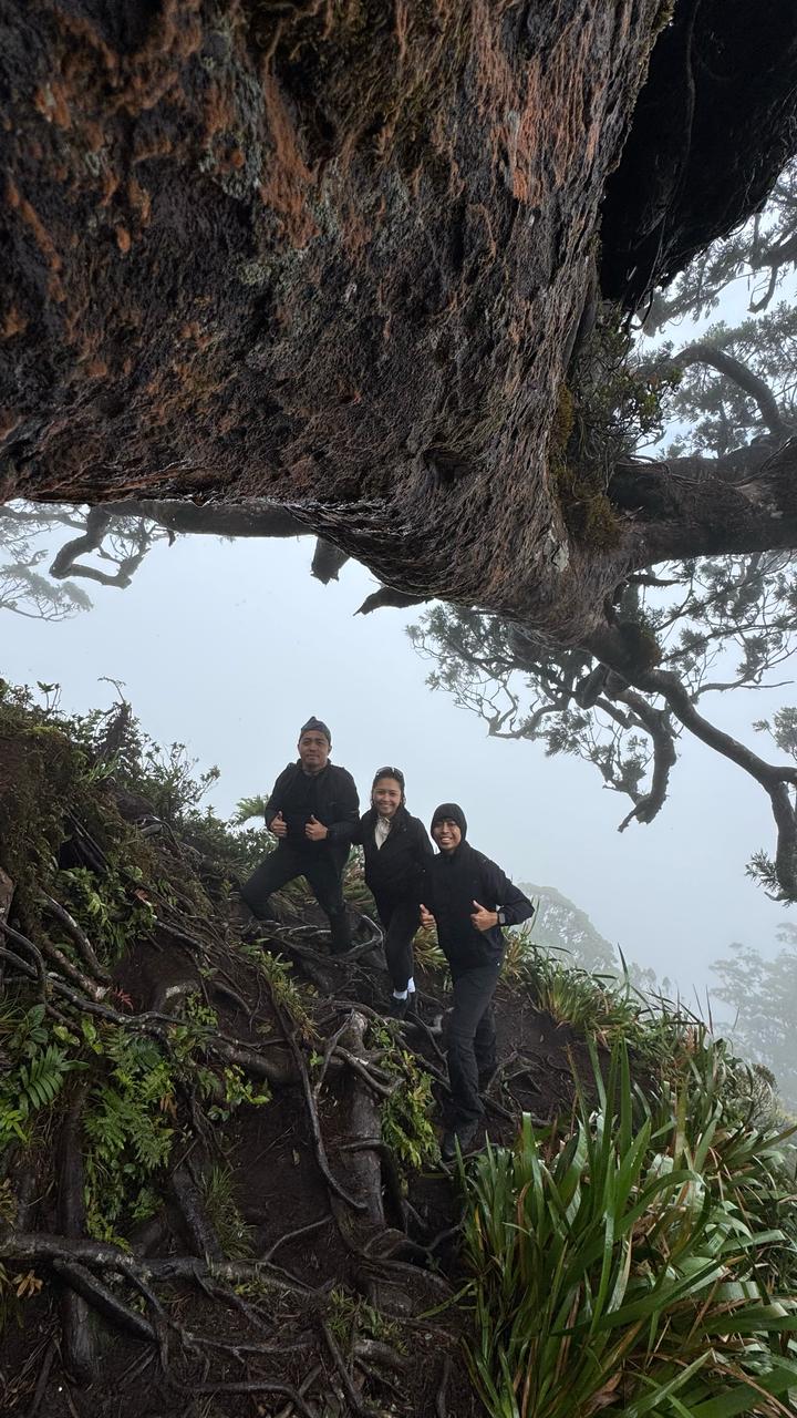
After taking quick photos, the strong winds pushed us to descend before 8:30 AM. We had a hearty breakfast back at the campsite, then packed up for our descent via the Bediao Trail.
On the second day, we passed by Lake Yagumyum. A smaller, hidden lake where we stopped for lunch. It also serves as a campsite for those taking the 3-day trek entering from the Dauin side.
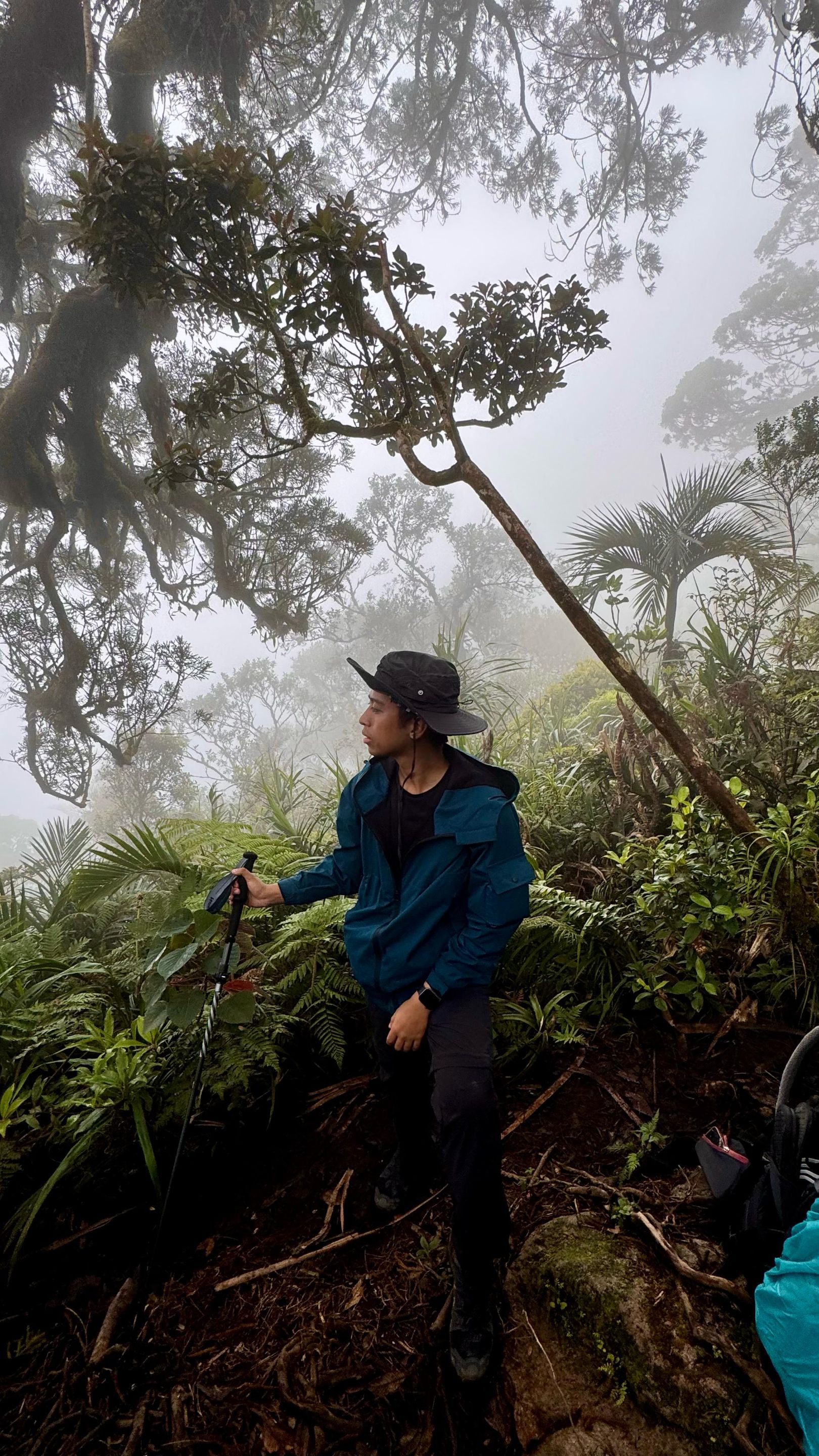
Further along the descent, we crossed the breathtaking Calawig Ridge, a narrow trail that’s not for the faint-hearted. One wrong step could cost you your life, but the views were absolutely worth it.
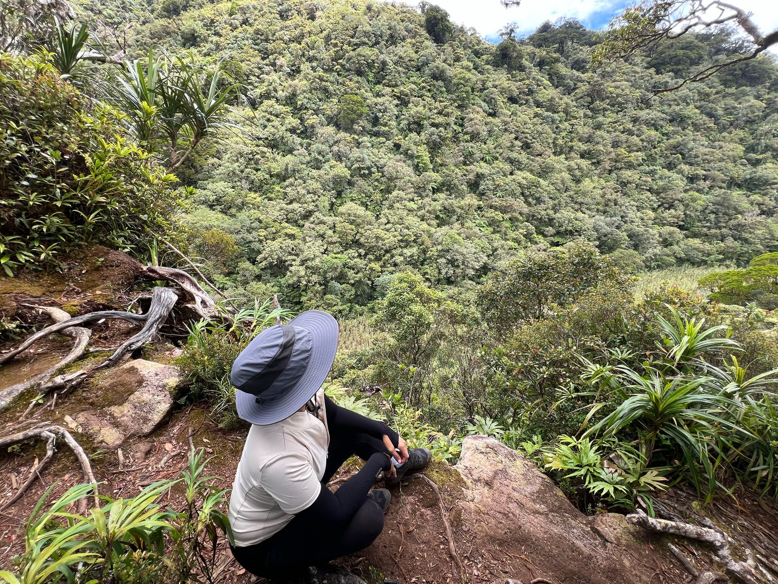
The descent via Bediao was steep and technical, with downhill sections that pushed our knees and ankles to their limits. It was a full-body experience —hiking, sliding, bracing ourselves against trees, roots and branches, staying focused on every step.
Our total climb took 2 days and 1 night, but the memories will last a lifetime. That night, the campsite was packed with about 80 other campers. The temperature dropped significantly, but somehow, I still managed to sleep well. And let me tell you nothing beats morning coffee at Lake Nailig after a brutal day of hiking.
Huge thanks to our amazing organizers, The Trail Trekkers, Sir Wen Dell and Team. Special shoutout to Charlotte for being the sweetest, even giving us chocolates to bring on the trail. Here’s why I highly recommend them:
- Accommodating and Welcoming – Even though we went past the expected itinerary (we exited way past 5:00 PM instead of 2:30 PM), they patiently waited and even brought us to a nearby house to freshen up before dropping us at Robinsons. Charlotte also kept checking in on us after the hike. She really is the sweetest.
- Professional and On Time – For our 5:30 AM pickup, they were already waiting outside our hotel. Huge shoutout to our friendly guide and porter, Master Joey and Joel, for keeping us safe and sound. The campsite was jam-packed when we arrived, and there was hardly enough room to pitch our tent, but they managed to improvise and find us a cozy spot.
- Delicious Trail Food – Kuya Joey cooked hearty meals. The pipino salad with apples was my favorite. Even though there were just three of us in the group, there was more than enough food to keep us fueled the entire time. You will never go hungry if you’re with The Trail Trekkers.
This climb wasn’t easy, and carrying a 10-kilogram backpack made everything harder, but when I saw Lake Nailig and later stood at the summit, I knew it was all worth it. Mt. Talinis is a beast, it was tough, raw, and humbling but she’s also incredibly beautiful. This climb reminded me why I fell in love with hiking in the first place: not just for the views, but for the journey, the struggle, and the unexpected stories that come with it.
To my friends who were budol-ed into training for three months and then climbing one of the toughest peaks in the Philippines — salamat, sorry, and I love you. I’ll probably be in trouble if I suggest another major climb too soon... so for now, I’ll just enjoy the memories, the photos, and the fact that you still haven’t unfriended me. 😂
Until the next summit.

Liked what you read? show some love by sharing your comments and upvote the content. Feel free to re-blogged the post and help spread positivity by paying it forward.
Photos credits to Louji & Troy and their amazing photography skills, Thank you for always taking amazing pictures of me. Some images may have been shared to our social media accounts prior posting to the blog.


Comments